Develop technology to make life better
Develop technology to make life better
Here is my technology repo.
Anyone can use my work.
Feel free to use it to help others.
I. Demo
- Drone Vision
Click the image to watch video clip.- Trajectory planning (Drone control using ROS2)
- Object detection (Customized YOLOv5)
- Localization (Drone-Visual SLAM in farming)
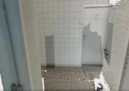
- Structure from Motion (Point Cloud Processing)
developed at hexafarms
- 3D reconstruction
Click the image to watch video clip.
developed at hexafarms
- Data Science
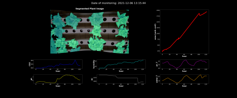
Click the image to watch video clip.- Image Segmentation (Holystic Image Class)
- Data Processing (Pandas)
- Visualization (Matplotlib, Seaborn)
developed at hexafarms
- Image processing
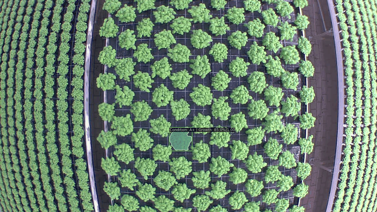
- Instant Segmentation (Custom-made Holystic Image Class)
- Image-tabular data combined Classification
- Time-series analysis for growth
developed at hexafarms
- Web application: Sensor and User accounts management
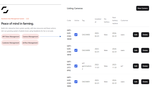
- Full-stack dev
developed at hexafarms
- Full-stack dev
- LLM powered web chatbot
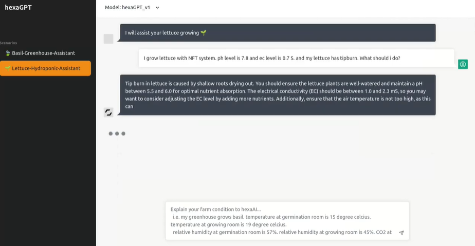
- Natural Language Processing, Word Embedding
- Design Concurrency Functionality
- Prompt Engineering
developed at hexafarms
- MLOPs&HyperParameter Tuning
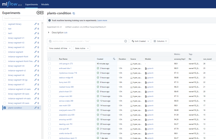
- Fully Open source-based full MLOps-HyperParameter tuning pipeline
- Time-series Forecast
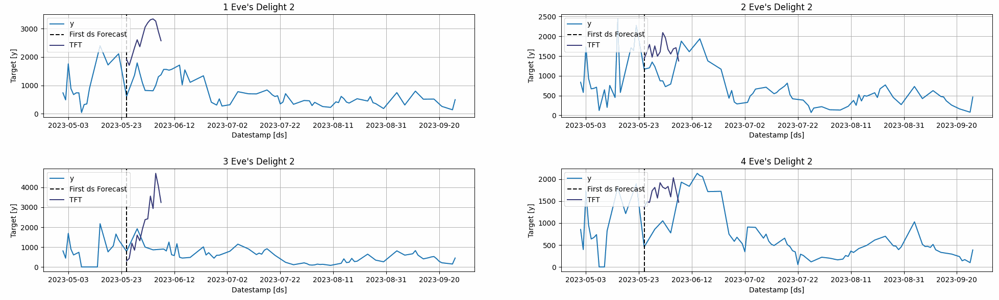
- Develop domain knowledge-supported custom ML MultiConstrainedLinearRegression
- Feature based Imputation (Transformer/ML-based, statistic)
- Feature Engineering
- XAI (Explainable AI) to understand why model performs better or worse developed at hexafarms
II. More Source Codes
- openHexa
- MultiConstrainedLinearRegression
- cvOps
- Compute pixel’s actual dimension
- YOLO data generator
- Image classification & mass estimation based on segmentation mask
- Image cropping for generating training samples
- Image Segmentation using Graph-cut
- Wildfire prediction using timeseires data
- MLflow+HyperOpt+MMOpenLab wraper
- Berlin Reservation Bot
III. Research
- Deep Learning-Based Semiautomatic Generation of HD maps from Aerial Imagery, Master thesis
Sharing the source code requires approval of the institute, ika. Contact me if you are interested in the algorithm in detail. - Deep Aerial Mapper: TBD
IV. Learning
- Camera Parameter
- Point Cloud Library
- 3D Reconstruction
- Color and Illumination
- Feature extraction
- Plant nutrient deficiency
- Public Leaf dataset
- Plant biology
- ROS2, Udemy
- Advanced C++, Coursera
- Data Structure
- Airflow, Udemy
- Open3d
- Elixir, Phoenix